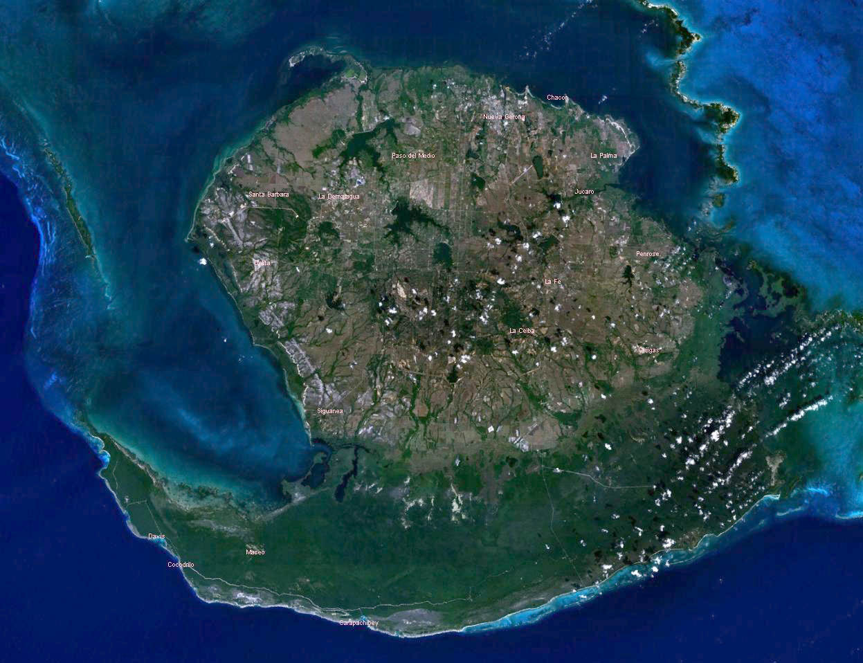
lighthouse · Isla de la Juventud
Carapachibey Lighthouse
Carapachibey Lighthouse est un(e) phare à Isla de la Juventud, Cuba. Il se situe approximativement à 21.4483°, -82.9247°. Parmi les lieux cartographiés à proximité figure
Aperçu
lighthouse in Cuba
Carapachibey Lighthouse est un(e) phare à Isla de la Juventud, Cuba. Il se situe approximativement à 21.4483°, -82.9247°.
L'histoire de ce lieu
L'édifice remonte à 1949.
À vol d'oiseau, le lieu se trouve à 50.5 km de sa capitale provinciale, à 193.9 km de La Havane et à 45.4 km de l'aéroport à vols réguliers le plus proche. Wikidata indique une fondation en 1949.
Les lieux répertoriés les plus proches dans l'atlas sont Catedral de San Rosendo (à 133.7 km au nord-ouest), Museo de Arte Pinar del Río (à 133.9 km au nord-ouest), Teatro Pedro Zaydén (à 134.0 km au nord-ouest), Estadio Capitán San Luis (à 134.3 km au nord-ouest), Jardín botánico de Pinar del Río (à 136.5 km au nord-ouest) et Playa Roja (à 21.4 km au nord).
Points forts
Verified highlights
Source-backed classifications from the CubaAtlas record — each opens the places that share it. No star ratings.
Your companion for Carapachibey Lighthouse
honest data · every value datedConditions
No dataLive weather conditions aren't connected here yet. When they are, this strip will summarize what's realistic to do today — and flag anything to check first — each value stamped with how fresh it is and where it came from.
Get there
21.44830, -82.92470Opens your maps app for turn-by-turn directions. CubaAtlas doesn't track your location.
Tropical outlook
LiveChecking the National Hurricane Center…
Weather
No dataAir temperature, wind, rain chance and UV for planning your day.
Weather adapters (NOAA + Cuba's INSMET) are the next feed to wire — each value will be stamped with its observation time and source.
Wildlife
LiveLoading recent wildlife records…
Daylight & season
Local time CDT (UTC−4). Computed from the date and coordinates — accurate to about a minute. Recent
Within the Atlantic hurricane season (Jun 1 – Nov 30). Check active advisories before coastal or boating plans.
Seismic activity
LiveChecking USGS for recent seismic activity…
Emergency
- 106Police (PNR)Recent
- 104Ambulance / medicalRecent
- 105FireRecent
- +53 7 866 4499Asistur (traveler assistance)Recent
State travel-assistance service for visitors (medical, legal, financial help).
These are Cuba's publicly published national numbers. Coverage, language support, and response times vary by area and are not verified in real time — confirm the correct local number with your accommodation on arrival.
CubaAtlas states how much it knows and how fresh it is. Values marked “No data” aren't connected yet — we show you the official source instead of guessing. Not for navigation, rescue, or legal decisions.
What's near Carapachibey Lighthouse
Lieux à proximité
Distances are straight-line, measured between recorded coordinates — not driving distance.
- Playa RojaIsla de la Juventud21 km✈ 30 km GER
- Catedral de San RosendoPinar del Río134 km✈ 114 km GER
- Museo de Arte Pinar del RíoPinar del Río134 km✈ 114 km GER
- Teatro Pedro ZaydénPinar del Río134 km✈ 114 km GER
- Estadio Capitán San LuisPinar del Río134 km✈ 114 km GER
- Jardín botánico de Pinar del RíoPinar del Río137 km✈ 117 km GER
Lieux cartographiés à proximité
Lieux nommés référencés dans OpenStreetMap aux alentours, du plus proche au plus lointain, avec leur distance.
Parmi les lieux cartographiés à proximité figurent Faro de Carapachibey, Carpachibey, Laguna Alvariño, Carapachibey, Rincón del Guanal, Punta Barranca, Cabo Pepe et Cerros del Monte.
- Faro de Carapachibey · lighthouse
- 0.0 km
- Carpachibey · locality
- 1.2 km
- Laguna Alvariño · lagoon
- 3.5 km
- Carapachibey · estate
- 5.8 km
- Rincón del Guanal · hamlet
- 11.0 km
- Punta Barranca · point
- 11.2 km
- Cabo Pepe · cape
- 16.0 km
- Cerros del Monte · hills
- 29.3 km
Official information and sources
generated from facts
- Wikidatageographic
- Wikimedia Commonsmedia