mountain · Santiago de Cuba
Loma el Jobo
Loma el Jobo est un(e) montagne à Santiago de Cuba, Cuba. Il se situe approximativement à 20.0917°, -76.3525°. Parmi les lieux cartographiés à proximité figurent La Cambu
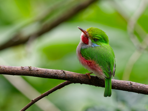
(c) Lionel CASSET, some rights reserved (CC BY-NC)
Aperçu
mountain in Cuba
Loma el Jobo est un(e) montagne à Santiago de Cuba, Cuba. Il se situe approximativement à 20.0917°, -76.3525°.
À vol d'oiseau, le lieu se trouve à 55.9 km de sa capitale provinciale, à 706.6 km de La Havane et à 44.0 km de l'aéroport à vols réguliers le plus proche.
Les lieux répertoriés les plus proches dans l'atlas sont Alto del Farallón Colorado (à 3.9 km au est), La Meseta (à 3.9 km au est), Loma Comején (à 6.8 km au sud-ouest), Sierra Maestra (à 8.0 km au ouest), Alto de Gamitas (à 8.0 km au ouest) et Tercer Frente (à 9.3 km au nord).
Points forts
Your companion for Loma el Jobo
honest data · every value datedConditions
No dataLive weather conditions aren't connected here yet. When they are, this strip will summarize what's realistic to do today — and flag anything to check first — each value stamped with how fresh it is and where it came from.
Get there
20.09170, -76.35250Opens your maps app for turn-by-turn directions. CubaAtlas doesn't track your location.
Tropical outlook
LiveChecking the National Hurricane Center…
Weather
No dataAir temperature, wind, rain chance and UV for planning your day.
Weather adapters (NOAA + Cuba's INSMET) are the next feed to wire — each value will be stamped with its observation time and source.
Wildlife
LiveLoading recent wildlife records…
Daylight & season
Local time CDT (UTC−4). Computed from the date and coordinates — accurate to about a minute. Recent
Within the Atlantic hurricane season (Jun 1 – Nov 30). Check active advisories before coastal or boating plans.
Water & safety
No dataWhether the water and conditions look manageable today for swimming or wading.
Once sea state and any advisories are connected, this frames conditions as favorable, use-caution, or not-recommended — always with the reason. It will never certify safety; final judgment is yours and the local lifeguard's.
Seismic activity
LiveChecking USGS for recent seismic activity…
Emergency
- 106Police (PNR)Recent
- 104Ambulance / medicalRecent
- 105FireRecent
- +53 7 866 4499Asistur (traveler assistance)Recent
State travel-assistance service for visitors (medical, legal, financial help).
These are Cuba's publicly published national numbers. Coverage, language support, and response times vary by area and are not verified in real time — confirm the correct local number with your accommodation on arrival.
CubaAtlas states how much it knows and how fresh it is. Values marked “No data” aren't connected yet — we show you the official source instead of guessing. Not for navigation, rescue, or legal decisions.
What's near Loma el Jobo
Lieux à proximité
Distances are straight-line, measured between recorded coordinates — not driving distance.
Lieux cartographiés à proximité
Lieux nommés référencés dans OpenStreetMap aux alentours, du plus proche au plus lointain, avec leur distance.
Parmi les lieux cartographiés à proximité figurent La Cambula, Cambulita, El Oro Arriba, Estribo del Jobo, Arroyón, La Única, Santa Úrsula, Cristina Segunda, Los Monos Abajos, Habana de Buena Vista, Los Mangos de Buenavista, Victorino, Cañamazo, Campo de béisebol, Tropical Contramaestre SA et Chely.
- La Cambula · hamlet
- 1.6 km
- Cambulita · hamlet
- 2.3 km
- El Oro Arriba · hamlet
- 3.1 km
- Estribo del Jobo · hill
- 4.6 km
- Arroyón · hamlet
- 6.4 km
- La Única · mine
- 6.6 km
- Santa Úrsula · hamlet
- 7.1 km
- Cristina Segunda · mine
- 8.3 km
- Los Monos Abajos · hamlet
- 8.7 km
- Habana de Buena Vista · hamlet
- 9.5 km
- Los Mangos de Buenavista · hamlet
- 9.6 km
- Victorino · village
- 10.9 km
- Cañamazo · hamlet
- 12.0 km
- Campo de béisebol · stadium
- 20.2 km
- Tropical Contramaestre SA · works
- 25.8 km
- Chely · cuban kitchen
- 29.9 km
Around Loma el Jobo
56 named civic, cultural, natural and service places are mapped within about 15 km of Loma el Jobo, across 26 categories. Open any category to see it on the map, centred on Loma el Jobo.
🏛️ Culture & heritage 7
⛰️ Nature & terrain 8
🏭 Industry & resources 2
🏥 Health & care 4
🎓 Education 7
🏦 Civic & services 11
🚉 Transport 2
🏟️ Sport & leisure 4
⛪ Faith 1
🛒 Shops & markets 5
🛏️ Stay 5
What Loma el Jobo makes
2 working sites mapped — energy, industry, mining, farming, fishing and ports.The whole economy →
🏭 Industry 2
Base de Ómnibus · Centro de beneficio de Cafe y Cacao
Official information and sources
generated from facts
- Wikidatageographic
- Wikimedia Commonsmedia