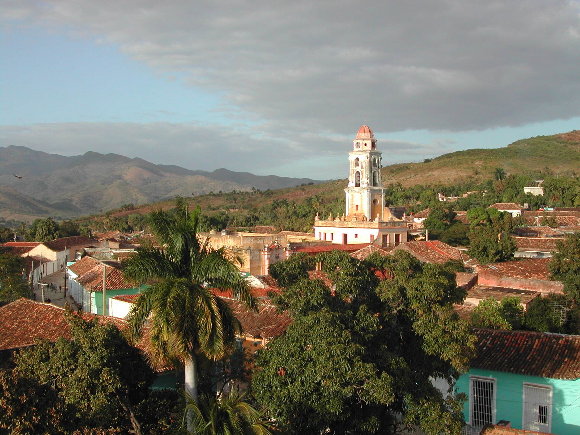
town · Sancti Spíritus
Trinidad
Trinidad est un(e) bourg à Sancti Spíritus, Cuba. Il se situe approximativement à 21.8039°, -79.9847°. Parmi les lieux cartographiés à proximité figurent Casa de la Cultu
Aperçu
Trinidad is a town in the province of Sancti Spíritus, central Cuba. Together with the nearby Valle de los Ingenios, it has been a UNESCO World Heritage Site since 1988, because of its historical importance as a center of the sugar trade in the 18th and 19th centuries. Trinidad is one of the best-preserved cities in the Caribbean from the time when the sugar trade was the main industry in the region.
Trinidad est un(e) bourg à Sancti Spíritus, Cuba. Il se situe approximativement à 21.8039°, -79.9847°.
L'une des sept villas d'origine
Ce fut la troisième des sept villas tracées par Diego Velázquez de Cuéllar, fondée en 1514 sous le nom de La Santísima Trinidad. Y sont nés : Catalina Berroa, compositrice cubaine (1849–1911), Yaniel Carrero, athlète cubain (n. 1995) et José Manuel Jiménez Berroa, pianiste, compositeur cubain (1851–1917). Y sont morts : Manuel Eugenio Fajardo Rivero (1930–1960). Trinidad et sa vallée sucrière forment un seul bien inscrit à l'UNESCO depuis 1988. Les rues pavées de galets que l'on foule aujourd'hui datent de l'époque où le sucre payait tout.
À vol d'oiseau, le lieu se trouve à 57.7 km de sa capitale provinciale, à 284.8 km de La Havane et à 2.2 km de l'aéroport à vols réguliers le plus proche. Wikidata indique une population de 51 994, une superficie de 1 155 km², une altitude de 60 m, une fondation en 1515, le code postal 62600.
Les lieux répertoriés les plus proches dans l'atlas sont Cienfuegos (à 60.4 km au nord-ouest), Playa Ancón (à 6.6 km au sud) et Santa Clara (à 67.1 km au nord).
Il est associé à architecture coloniale, site du patrimoine mondial de l'UNESCO, vieille ville historique et musique live.
Points forts
Verified highlights
- architecture coloniale
- site du patrimoine mondial de l'UNESCO
- vieille ville historique
- musique live
- vie nocturne
- histoire
- culture locale
Source-backed classifications from the CubaAtlas record — each opens the places that share it. No star ratings.
Your companion for Trinidad
honest data · every value datedConditions
No dataLive weather conditions aren't connected here yet. When they are, this strip will summarize what's realistic to do today — and flag anything to check first — each value stamped with how fresh it is and where it came from.
Get there
21.80390, -79.98470Opens your maps app for turn-by-turn directions. CubaAtlas doesn't track your location.
Tropical outlook
LiveChecking the National Hurricane Center…
Weather
No dataAir temperature, wind, rain chance and UV for planning your day.
Weather adapters (NOAA + Cuba's INSMET) are the next feed to wire — each value will be stamped with its observation time and source.
Wildlife
LiveLoading recent wildlife records…
Daylight & season
Local time CDT (UTC−4). Computed from the date and coordinates — accurate to about a minute. Recent
Within the Atlantic hurricane season (Jun 1 – Nov 30). Check active advisories before coastal or boating plans.
Seismic activity
LiveChecking USGS for recent seismic activity…
Emergency
- 106Police (PNR)Recent
- 104Ambulance / medicalRecent
- 105FireRecent
- +53 7 866 4499Asistur (traveler assistance)Recent
State travel-assistance service for visitors (medical, legal, financial help).
These are Cuba's publicly published national numbers. Coverage, language support, and response times vary by area and are not verified in real time — confirm the correct local number with your accommodation on arrival.
CubaAtlas states how much it knows and how fresh it is. Values marked “No data” aren't connected yet — we show you the official source instead of guessing. Not for navigation, rescue, or legal decisions.
What's near Trinidad
Where to stay, eat & explore in Trinidad
Lieux à proximité
Distances are straight-line, measured between recorded coordinates — not driving distance.
Lieux cartographiés à proximité
Lieux nommés référencés dans OpenStreetMap aux alentours, du plus proche au plus lointain, avec leur distance.
Parmi les lieux cartographiés à proximité figurent Casa de la Cultura Julio Cuevas, Museo de Historia de Trinidad, Benito Ortiz, Motel Las Cuevas, Ermita de Santa Ana, Hotel Cubanacan Las Cuevas, Loma de la Vigía, Zoológico de Trinidad, Fábrica de cigarrillos "Juan Mata Reyes", Santiago Escobar, Finca San Juan, Loma Pan Redondo, Loma El Amparo, Laguna Delicias et Patrocinia.
- Casa de la Cultura Julio Cuevas · attraction
- 0.0 km
- Museo de Historia de Trinidad · museum
- 0.1 km
- Benito Ortiz · gallery
- 0.1 km
- Motel Las Cuevas · resort
- 1.2 km
- Ermita de Santa Ana · heritage site
- 1.3 km
- Hotel Cubanacan Las Cuevas · hotel
- 1.3 km
- Loma de la Vigía · peak
- 1.4 km
- Zoológico de Trinidad · park
- 1.4 km
- Fábrica de cigarrillos "Juan Mata Reyes" · works
- 1.5 km
- Santiago Escobar · hamlet
- 2.7 km
- Finca San Juan · locality
- 6.6 km
- Loma Pan Redondo · hill
- 6.9 km
- Loma El Amparo · hill
- 10.3 km
- Laguna Delicias · lake
- 11.2 km
- Patrocinia · locality
- 24.1 km
Around Trinidad
1,253 named civic, cultural, natural and service places are mapped within about 15 km of Trinidad, across 33 categories. Open any category to see it on the map, centred on Trinidad.
Notable near Trinidad
Área Protegida Topes de Collantes
Parks & reserves
Topes de Collantes is a nature reserve park in the Escambray Mountains range in Cuba. It also refers to the third highest peak in the reserve, where a small settlement and tourist center is located, all sharing the same name.
Plaza Mayor
Urban parks & plazas
The Plaza Mayor in Trinidad, Cuba, is the historic centre of the town, declared a UNESCO World Heritage Site in 1988.
_03.jpg)
Plaza Mayor
Attractions
The Plaza Mayor in Trinidad, Cuba, is the historic centre of the town, declared a UNESCO World Heritage Site in 1988.
🏛️ Culture & heritage 80
🚬 Cuban craft & cuisine 20
⛰️ Nature & terrain 19
🌾 Farming & fishing 12
🏭 Industry & resources 8
🏥 Health & care 7
🎓 Education 18
🏦 Civic & services 32
🚉 Transport 8
🏟️ Sport & leisure 27
⛪ Faith 4
🛒 Shops & markets 27
🛏️ Stay 991
What Trinidad makes
12 working sites mapped — energy, industry, mining, farming, fishing and ports.The whole economy →
⚡ Energy 2
Batería Grupo Electrógeno Trinidad · Planta Eléctrica Trinidad
🏭 Industry 8
Base de Ómnibus · Batería Grupo Electrógeno Trinidad · Empresa de Transporte Escolar Trinidad · Fábrica de cigarrillos "Juan Mata Reyes" · …
🌱 Farming 1
Criadero
🐟 Fishing 1
Criadero
Industrial heritage
2 pre-1959 sites in and around Trinidad — sugar centrales, railways, mines and ports.The 1959 heritage map →
- Valle de los Ingeniossugar
- Torre de Manaca-Iznagasugar
Official information and sources
generated from facts
- Wikidatageographic
- Wikimedia Commonsmedia