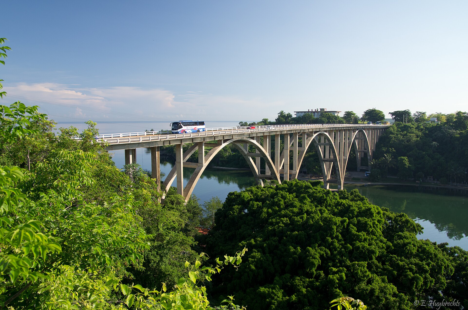
architecture · Matanzas
Canimar Bridge
Canimar Bridge ist ein(e) Wahrzeichen in Matanzas, Kuba. Es liegt etwa bei 23.0392°, -81.4969°. Zu den in der Nähe kartierten Orten zählen Punto náutico y baile de aboríg
Überblick
bridge in Cuba
Canimar Bridge ist ein(e) Wahrzeichen in Matanzas, Kuba. Es liegt etwa bei 23.0392°, -81.4969°.
Die Geschichte dieses Ortes
Eröffnet wurde er 1951.
Luftlinie liegt der Ort 8.3 km von seiner Provinzhauptstadt entfernt, 89.4 km von Havanna und 6.3 km vom nächsten Flughafen mit Linienverkehr.
Die nächstgelegenen erfassten Orte im Atlas sind Punta Maya Lighthouse (6.6 km im Norden), San Severino Castle (6.9 km im Westen), Concordia Bridge (Matanzas) (7.9 km im Westen), Sauto Theater (7.9 km im Westen), Museo Historico Provincial de Matanzas (7.9 km im Westen) und Playa Bacalao (3.4 km im Nordosten).
Highlights
Verified highlights
Source-backed classifications from the CubaAtlas record — each opens the places that share it. No star ratings.
Your companion for Canimar Bridge
honest data · every value datedConditions
No dataLive weather conditions aren't connected here yet. When they are, this strip will summarize what's realistic to do today — and flag anything to check first — each value stamped with how fresh it is and where it came from.
Get there
23.03920, -81.49690Opens your maps app for turn-by-turn directions. CubaAtlas doesn't track your location.
Tropical outlook
LiveChecking the National Hurricane Center…
Weather
No dataAir temperature, wind, rain chance and UV for planning your day.
Weather adapters (NOAA + Cuba's INSMET) are the next feed to wire — each value will be stamped with its observation time and source.
Wildlife
LiveLoading recent wildlife records…
Daylight & season
Local time CDT (UTC−4). Computed from the date and coordinates — accurate to about a minute. Recent
Within the Atlantic hurricane season (Jun 1 – Nov 30). Check active advisories before coastal or boating plans.
Seismic activity
LiveChecking USGS for recent seismic activity…
Emergency
- 106Police (PNR)Recent
- 104Ambulance / medicalRecent
- 105FireRecent
- +53 7 866 4499Asistur (traveler assistance)Recent
State travel-assistance service for visitors (medical, legal, financial help).
These are Cuba's publicly published national numbers. Coverage, language support, and response times vary by area and are not verified in real time — confirm the correct local number with your accommodation on arrival.
CubaAtlas states how much it knows and how fresh it is. Values marked “No data” aren't connected yet — we show you the official source instead of guessing. Not for navigation, rescue, or legal decisions.
What's near Canimar Bridge
Orte in der Nähe
Distances are straight-line, measured between recorded coordinates — not driving distance.
Kartierte Orte in der Nähe
In OpenStreetMap erfasste benannte Orte in der Umgebung, nach Entfernung, jeweils mit Angabe.
Zu den in der Nähe kartierten Orten zählen Punto náutico y baile de aborígenes, Carlos Aponte, Grupo AZCUBA, Canimao, Río Canímar, Huerta de la Universidad, 2 de Diciembre, Tienda online, Fruta Selectas, Tuambia, Matanzas (Área de seco), Santa Rita, La Reunión, Parque La Fraternidad (Peñas Altas), Guamácara, Guanábana, Lomas del Jacán und Andrea.
- Punto náutico y baile de aborígenes · attraction
- 0.1 km
- Carlos Aponte · artwork
- 0.2 km
- Grupo AZCUBA · works
- 0.2 km
- Canimao · hotel
- 0.6 km
- Río Canímar · river
- 0.8 km
- Huerta de la Universidad · farm
- 1.4 km
- 2 de Diciembre · neighbourhood
- 2.2 km
- Tienda online, Fruta Selectas, Tuambia, Matanzas (Área de seco) · market
- 3.0 km
- Santa Rita · hamlet
- 3.4 km
- La Reunión · hamlet
- 4.1 km
- Parque La Fraternidad (Peñas Altas) · park
- 4.3 km
- Guamácara · river
- 6.0 km
- Guanábana · village
- 6.6 km
- Lomas del Jacán · hills
- 25.1 km
- Andrea · locality
- 29.8 km
Around Canimar Bridge
566 named civic, cultural, natural and service places are mapped within about 15 km of Canimar Bridge, across 31 categories. Open any category to see it on the map, centred on Canimar Bridge.
Notable near Canimar Bridge

Museo del Arte
Museums
El Museo de Arte de Matanzas, también llamado Museo Lorenzo Padilla Díaz, es el Museo de arte cubano y africano de Matanzas, Cuba, con una destacada colección de grabados holandeses que abarcan desde el siglo XVI hasta el siglo XX.

Teatro Sauto
Theatres & arts
The Sauto Theater opened in 1863 in Matanzas, Cuba, and has since then been a proud symbol of the city. The U-shaped 775-seat theatre is almost entirely covered with wood-panelling. It has three balconies, and its floor can be raised to convert the auditorium into a ballroom. The original theater curtain is a painting of the Puente de la Concordia over the Yumurí River. The lobby is graced by Carrara marble statues of Greek goddesses and the main hall ceiling bears paintings of the muses.
Seminario Teológico
Universities & colleges
El Seminario Evangélico de Teología (SET) es un seminario protestante interdenominacional ubicado en Matanzas, Cuba, que ofrece estudios de pregrado en Bachillerato en Teología (BTh), Bachillerato en Educación Cristiana (BCE) y Licenciatura en Teología; y de postgrado en Maestría en Teología (MTh). Fue fundado en 1946 por tres denominaciones protestantes: Iglesia Metodista en Cuba, Iglesia Presbiteriana-Reformada en Cuba y la Iglesia Episcopal de Cuba. En 2006 la Iglesia Metodista en Cuba se separó del seminario formando su propia institución de educación teológica: el Seminario Evangélico…
.jpg)
Cueva Saturno
Springs, caves & falls
Cueva de Saturno, or Saturn Cave, is a cenote cave located near Varadero, Matanzas Province, Cuba. The cave consists of a large opening, the denote, and some offshoot caverns. Stalactites and blind cavefish and cave shrimp. Scuba diving is popular in the cenote itself.

Estadio Victoria de Girón
Stadiums & sport
The Estadio Victoria de Girón is a multi-use stadium in Matanzas, Cuba. It is currently used mostly for baseball games and is the home stadium of Matanzas Cocodrilos. The stadium holds 22,000 and was built in 1977.
Monumento a Antonio Guiteras y Carlos Aponte
Historic & heritage
Antonio Guiteras y Holmes was a leading politician in Cuba during the 1930s.
🏛️ Culture & heritage 92
🚬 Cuban craft & cuisine 6
⛰️ Nature & terrain 6
🌾 Farming & fishing 10
🏭 Industry & resources 37
🏥 Health & care 47
🎓 Education 62
🏦 Civic & services 79
🚉 Transport 6
🏟️ Sport & leisure 30
⛪ Faith 19
🛒 Shops & markets 67
🛏️ Stay 105
What Canimar Bridge makes
49 working sites mapped — energy, industry, mining, farming, fishing and ports.The whole economy →
⚡ Energy 2
Batería Grupo Electrógeno Frigorífico · Termoeléctrica Antonio Guiteras
🏭 Industry 37
Base de Aseguramiento de la ENIA Matanzas · Base de Ómnibus Transmetro · Base de ómnibus urbanos · Base de Ómnibus Urbanos Yumurí · …
🌱 Farming 10
Huerta de la Universidad · Huerto · Huerto · Huerto · …
Industrial heritage
6 pre-1959 sites in and around Canimar Bridge — sugar centrales, railways, mines and ports.The 1959 heritage map →
- Port of Matanzasport
- Los Mangosrailway
- Margotrailway
- Matanzas (Versalles)railway
- Matanzas Swing Bridgerailway
- Menarailway
Official information and sources
generated from facts
- Wikidatageographic
- Wikimedia Commonsmedia