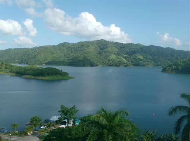
waterfall · Villa Clara
El Salto del Hanabanilla
El Salto del Hanabanilla ist ein(e) Wasserfall in Villa Clara, Kuba. Es liegt etwa bei 22.0962°, -80.0664°. Zu den in der Nähe kartierten Orten zählen Hanabanilla, Hidroe
Überblick
El Salto del Hanabanilla, also known as Hanabanilla, is a Cuban village and consejo popular of the municipality of Manicaragua, Villa Clara Province. As of 2014 the town has 137 homes making up a total of 436 inhabitants. Is a mountain resort famous for the homonym lake.
Description from Wikipedia, licensed under CC BY-SA.
El Salto del Hanabanilla ist ein(e) Wasserfall in Villa Clara, Kuba. Es liegt etwa bei 22.0962°, -80.0664°.
Die Geschichte dieses Ortes
Der Ort geht auf 1802 zurück.
Luftlinie liegt der Ort 36.1 km von seiner Provinzhauptstadt entfernt, 261.8 km von Havanna und 35.0 km vom nächsten Flughafen mit Linienverkehr. Wikidata verzeichnet eine Höhe von 350 m, eine Gründung im Jahr 1802.
Die nächstgelegenen erfassten Orte im Atlas sind Manicaragua (11.0 km im Nordosten), Jibacoa (11.8 km im Südosten), Cumanayagua (15.2 km im Nordwesten), Güinía de Miranda (21.5 km im Osten), Topes de Collantes (24.6 km im Süden) und Valle del Cacao (1.4 km im Süden).
Es wird mit lokale Kultur, Geschichte und Kalksteinhügel in Verbindung gebracht.
Highlights
Verified highlights
Source-backed classifications from the CubaAtlas record — each opens the places that share it. No star ratings.
Your companion for El Salto del Hanabanilla
honest data · every value datedConditions
No dataLive weather conditions aren't connected here yet. When they are, this strip will summarize what's realistic to do today — and flag anything to check first — each value stamped with how fresh it is and where it came from.
Get there
22.09620, -80.06640Opens your maps app for turn-by-turn directions. CubaAtlas doesn't track your location.
Tropical outlook
LiveChecking the National Hurricane Center…
Weather
No dataAir temperature, wind, rain chance and UV for planning your day.
Weather adapters (NOAA + Cuba's INSMET) are the next feed to wire — each value will be stamped with its observation time and source.
Wildlife
LiveLoading recent wildlife records…
Daylight & season
Local time CDT (UTC−4). Computed from the date and coordinates — accurate to about a minute. Recent
Within the Atlantic hurricane season (Jun 1 – Nov 30). Check active advisories before coastal or boating plans.
Seismic activity
LiveChecking USGS for recent seismic activity…
Emergency
- 106Police (PNR)Recent
- 104Ambulance / medicalRecent
- 105FireRecent
- +53 7 866 4499Asistur (traveler assistance)Recent
State travel-assistance service for visitors (medical, legal, financial help).
These are Cuba's publicly published national numbers. Coverage, language support, and response times vary by area and are not verified in real time — confirm the correct local number with your accommodation on arrival.
CubaAtlas states how much it knows and how fresh it is. Values marked “No data” aren't connected yet — we show you the official source instead of guessing. Not for navigation, rescue, or legal decisions.
What's near El Salto del Hanabanilla
Orte in der Nähe
Distances are straight-line, measured between recorded coordinates — not driving distance.
Kartierte Orte in der Nähe
In OpenStreetMap erfasste benannte Orte in der Umgebung, nach Entfernung, jeweils mit Angabe.
Zu den in der Nähe kartierten Orten zählen Hanabanilla, Hidroeléctrica Hanabanilla, Presa Hanabanilla, Presa Antigua, La Lima, Loma Ramírez, Serrana, La Campana, La Macagua, Guinea Likoni, Gestantes, El Tablón, El Jíbaro, Las Minas de San Fernando, Cobre und Entronque Minas.
- Hanabanilla · village
- 0.0 km
- Hidroeléctrica Hanabanilla · works
- 0.2 km
- Presa Hanabanilla · dam
- 0.4 km
- Presa Antigua · dam
- 0.4 km
- La Lima · hamlet
- 3.6 km
- Loma Ramírez · hill
- 4.0 km
- Serrana · locality
- 6.0 km
- La Campana · village
- 6.5 km
- La Macagua · hamlet
- 7.1 km
- Guinea Likoni · farm
- 7.3 km
- Gestantes · farm
- 7.7 km
- El Tablón · village
- 8.6 km
- El Jíbaro · hamlet
- 10.4 km
- Las Minas de San Fernando · locality
- 11.1 km
- Cobre · locality
- 11.7 km
- Entronque Minas · hamlet
- 11.9 km
Around El Salto del Hanabanilla
127 named civic, cultural, natural and service places are mapped within about 15 km of El Salto del Hanabanilla, across 27 categories. Open any category to see it on the map, centred on El Salto del Hanabanilla.
Notable near El Salto del Hanabanilla

Pico San Juan
Peaks & volcanoes
Pico San Juan is the highest point of the central area of the island of Cuba with 1,140 meters above sea level.
🏛️ Culture & heritage 9
🚬 Cuban craft & cuisine 4
⛰️ Nature & terrain 14
🌾 Farming & fishing 15
🏭 Industry & resources 13
🏥 Health & care 6
🎓 Education 20
🏦 Civic & services 13
🚉 Transport 2
🏟️ Sport & leisure 9
⛪ Faith 5
🛒 Shops & markets 11
🛏️ Stay 6
What El Salto del Hanabanilla makes
20 working sites mapped — energy, industry, mining, farming, fishing and ports.The whole economy →
⚡ Energy 3
Hidroeléctrica Hanabanilla · Parque Solar Fotovoltaico EMFRE Manicaragua · Parque Solar Fotovoltaico La Moza
🏭 Industry 13
Acueducto Municipal · Ema Cumanayagua · Embasadero · Empresa Acueducto y Alcantarillado · …
🌱 Farming 4
Campamento EJT · Vaquería · Vaquería · Vaquería Los Pinos
Official information and sources
generated from facts
- Wikidatageographic
- Wikimedia Commonsmedia