city · Artemisa
Bahía Honda
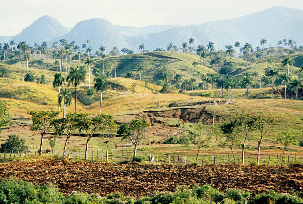
Bahía Honda is a city in Artemisa, Cuba. It is located at approximately 22.9064°, -83.1639°. Before 2011, the municipality belonged to Pinar del Río Province.
Overview
Bahía Honda is a municipality and town in the Artemisa Province of Cuba. Before 2011, the municipality belonged to Pinar del Río Province.
Description from the English Wikipedia (CC BY-SA); its figures may reflect a different year from the Wikidata facts.
Bahía Honda is a city in Artemisa, Cuba. It is located at approximately 22.9064°, -83.1639°.
The story of this place
Born here: Nancy Uranga, fencer (1954–1976), Romario Torrez, footballer (b. 2005) and Luis Casanova, Cuban baseball player (b. 1956).
In a straight line it lies 42.7 km from its provincial capital, 84.8 km from Havana and 77.8 km from the nearest airport with scheduled flights. Wikidata records a population of 43,483, an area of 784 km², an elevation of 25 m, the postal code 22600.
The nearest recorded places in the atlas are Arroyo de Piedra (15.9 km to the west), Soroa (19.2 km to the south-east), Modesto Serrano (San Cristobal) (22.3 km to the south), San Cristóbal (24.0 km to the south-east), Cabañas (26.0 km to the east) and Cayo Pájaro (2.6 km to the north-west).
Highlights
Verified highlights
Source-backed classifications from the CubaAtlas record — each opens the places that share it. No star ratings.
Your companion for Bahía Honda
honest data · every value datedConditions
No dataLive weather conditions aren't connected here yet. When they are, this strip will summarize what's realistic to do today — and flag anything to check first — each value stamped with how fresh it is and where it came from.
Get there
22.90640, -83.16390Opens your maps app for turn-by-turn directions. CubaAtlas doesn't track your location.
Tropical outlook
LiveChecking the National Hurricane Center…
Weather
No dataAir temperature, wind, rain chance and UV for planning your day.
Weather adapters (NOAA + Cuba's INSMET) are the next feed to wire — each value will be stamped with its observation time and source.
Wildlife
LiveLoading recent wildlife records…
Daylight & season
Local time CST (UTC−5). Computed from the date and coordinates — accurate to about a minute. Recent
Within the Atlantic hurricane season (Jun 1 – Nov 30). Check active advisories before coastal or boating plans.
Seismic activity
LiveChecking USGS for recent seismic activity…
Emergency
- 106Police (PNR)Recent
- 104Ambulance / medicalRecent
- 105FireRecent
- +53 7 866 4499Asistur (traveler assistance)Recent
State travel-assistance service for visitors (medical, legal, financial help).
These are Cuba's publicly published national numbers. Coverage, language support, and response times vary by area and are not verified in real time — confirm the correct local number with your accommodation on arrival.
CubaAtlas states how much it knows and how fresh it is. Values marked “No data” aren't connected yet — we show you the official source instead of guessing. Not for navigation, rescue, or legal decisions.
What's near Bahía Honda
Nearby places
Distances are straight-line, measured between recorded coordinates — not driving distance.
Mapped features nearby
Named places recorded in OpenStreetMap around this one, nearest first — distance shown for each.
Named places mapped nearby include Museo municipal, Loma del Coayal, Las Diez Caballerías, Arroyo Salado, Luis Carrasco, Loma Caldoso, El Roble, Rancho Mar, Manantiales, El Brujo, Loma El Tibisí, Loma Cuava, La Daguilla, Iglesia Metodista. Resplandece, Planta San Cristobal and EFAC José Martí.
- Museo municipal · museum
- 0.5 km
- Loma del Coayal · hill
- 0.8 km
- Las Diez Caballerías · locality
- 1.2 km
- Arroyo Salado · hamlet
- 1.6 km
- Luis Carrasco · village
- 6.1 km
- Loma Caldoso · peak
- 8.6 km
- El Roble · hamlet
- 9.1 km
- Rancho Mar · hamlet
- 10.2 km
- Manantiales · hamlet
- 10.6 km
- El Brujo · hamlet
- 10.8 km
- Loma El Tibisí · peak
- 11.0 km
- Loma Cuava · peak
- 11.2 km
- La Daguilla · peak
- 11.9 km
- Iglesia Metodista. Resplandece · place of worship
- 24.6 km
- Planta San Cristobal · works
- 26.0 km
- EFAC José Martí · works
- 28.9 km
Around Bahía Honda
71 named civic, cultural, natural and service places are mapped within about 15 km of Bahía Honda, across 23 categories. Open any category to see it on the map, centred on Bahía Honda.
Notable near Bahía Honda
Marine life records: 1,366
Marine life records
1,366 marine species records in this 5 km cell (OBIS). A record is one sighting or specimen, so this shows where surveys and observers have looked, not how many animals there are.
Reef
Coral reefs
Reef mapped in OpenStreetMap, about 3.6 km2 in extent. The data does not say whether it is coral, rock or other substrate.
🏝️ Cays, diving & fishing 18
🏛️ Culture & heritage 3
⛰️ Nature & terrain 19
🏭 Industry & resources 8
🏥 Health & care 3
🎓 Education 2
🏦 Civic & services 4
🏟️ Sport & leisure 3
⛪ Faith 1
🛒 Shops & markets 2
🛏️ Stay 8
What Bahía Honda makes
4 working sites mapped — energy, industry, mining, farming, fishing and ports.The whole economy →
⚡ Energy 1
Batería Grupo Electrógeno Bahía Honda
🏭 Industry 3
Antiguo Central Pablo de la Torriente Brau · Central Azucarero Harlem · Desguazadero de Buques
Industrial heritage
3 pre-1959 sites in and around Bahía Honda — sugar centrales, railways, mines and ports.The 1959 heritage map →
- Central Niágarasugar
- Central Orozcosugar
- Central Bahía Honda / ingenio Gerardosugar
Official information and sources
generated from facts
- Wikidatageographic
- Wikimedia Commonsmedia