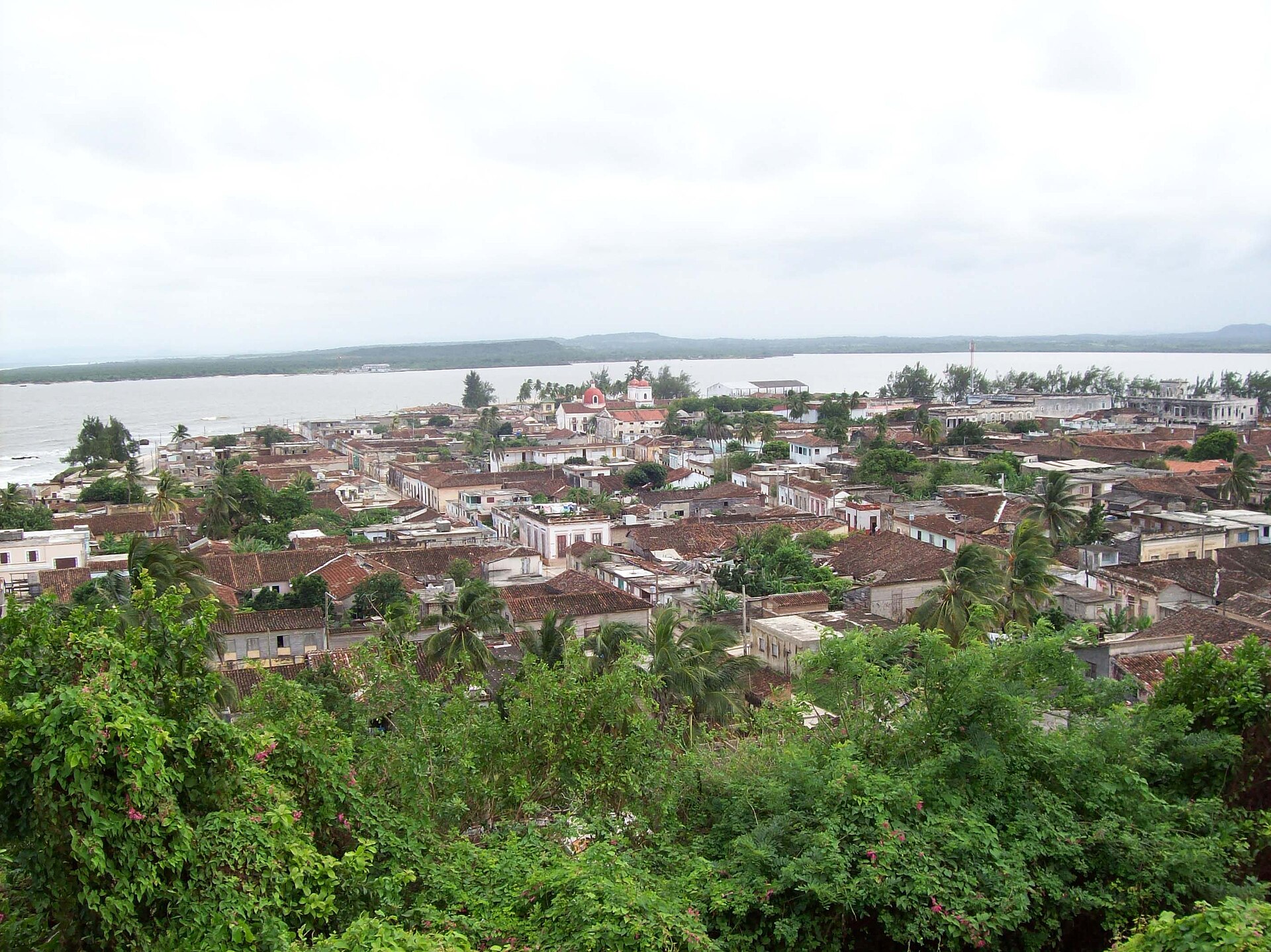
city · Holguín
Gibara
Gibara is a city in Holguín, Cuba. It is located at approximately 21.1077°, -76.1324°. Gibara is the fourth largest town by population and the ninth by area in Holguín.
Overview
Gibara is a town and municipality of the Province of Holguín in the Republic of Cuba. Gibara is the fourth largest town by population and the ninth by area in Holguín.
Description from the English Wikipedia (CC BY-SA); its figures may reflect a different year from the Wikidata facts.
Gibara is a city in Holguín, Cuba. It is located at approximately 21.1077°, -76.1324°.
The story of this place
The town dates from 1817. Born here: Guillermo Cabrera Infante, Cuban writer (1929–2005), Manuel Galbán, Cuban musician (1931–2011) and Juan José Martínez Casado, Cuban actor (1903–1987).
In a straight line it lies 28.0 km from its provincial capital, 679.8 km from Havana and 40.6 km from the nearest airport with scheduled flights. Wikidata records a population of 71,126, an area of 630 km², an elevation of 45 m, a founding date of 1817.
The nearest recorded places in the atlas are La Caridad (8.6 km to the south), Floro Pérez (14.3 km to the south-west), Caletones (16.1 km to the north-west), Santa Lucía (16.6 km to the south-east), Rafael Freyre (17.0 km to the south-east) and Playa Gibara (2.3 km to the south-east).
Highlights
Verified highlights
Source-backed classifications from the CubaAtlas record — each opens the places that share it. No star ratings.
Your companion for Gibara
honest data · every value datedConditions
No dataLive weather conditions aren't connected here yet. When they are, this strip will summarize what's realistic to do today — and flag anything to check first — each value stamped with how fresh it is and where it came from.
Get there
21.10770, -76.13240Opens your maps app for turn-by-turn directions. CubaAtlas doesn't track your location.
Tropical outlook
LiveChecking the National Hurricane Center…
Weather
No dataAir temperature, wind, rain chance and UV for planning your day.
Weather adapters (NOAA + Cuba's INSMET) are the next feed to wire — each value will be stamped with its observation time and source.
Wildlife
LiveLoading recent wildlife records…
Daylight & season
Local time CST (UTC−5). Computed from the date and coordinates — accurate to about a minute. Recent
Within the Atlantic hurricane season (Jun 1 – Nov 30). Check active advisories before coastal or boating plans.
Seismic activity
LiveChecking USGS for recent seismic activity…
Emergency
- 106Police (PNR)Recent
- 104Ambulance / medicalRecent
- 105FireRecent
- +53 7 866 4499Asistur (traveler assistance)Recent
State travel-assistance service for visitors (medical, legal, financial help).
These are Cuba's publicly published national numbers. Coverage, language support, and response times vary by area and are not verified in real time — confirm the correct local number with your accommodation on arrival.
CubaAtlas states how much it knows and how fresh it is. Values marked “No data” aren't connected yet — we show you the official source instead of guessing. Not for navigation, rescue, or legal decisions.
What's near Gibara
Nearby places
Distances are straight-line, measured between recorded coordinates — not driving distance.
Mapped features nearby
Named places recorded in OpenStreetMap around this one, nearest first — distance shown for each.
Named places mapped nearby include Iglesia LPN, Playa Bayado, Terminal De Ómnibus Gibara, Mercado Agropecuario, Hotel E Ordoño, Cueva de los Panaderos, Río Cacoyuquín, Cueva de la Masanga, La Ligera, La Caridad, La Vega de Yabazón, El Vapor, Candelaria Afuera, El Socarreño, casa de osmel and Áreas deportivas de Ciencias Médicas.
- Iglesia LPN · place of worship
- 0.2 km
- Playa Bayado · beach
- 0.3 km
- Terminal De Ómnibus Gibara · bus station
- 0.3 km
- Mercado Agropecuario · market
- 0.4 km
- Hotel E Ordoño · hotel
- 0.4 km
- Cueva de los Panaderos · cave
- 0.6 km
- Río Cacoyuquín · river
- 0.9 km
- Cueva de la Masanga · cave
- 3.3 km
- La Ligera · hamlet
- 5.6 km
- La Caridad · village
- 8.6 km
- La Vega de Yabazón · hamlet
- 9.3 km
- El Vapor · locality
- 10.8 km
- Candelaria Afuera · hamlet
- 11.3 km
- El Socarreño · hamlet
- 11.4 km
- casa de osmel · place of worship
- 25.6 km
- Áreas deportivas de Ciencias Médicas · sports centre
- 29.1 km
Around Gibara
174 named civic, cultural, natural and service places are mapped within about 15 km of Gibara, across 40 categories. Open any category to see it on the map, centred on Gibara.
Notable near Gibara
Cayo Bariay
Cays & islands
Cayo Bariay es un cayo de relevancia histórica y geográfica situado en la región nororiental de Cuba, en la provincia de Holguín. La historiografía cubana lo identifica como el lugar donde Cristóbal Colón desembarcó en la isla de Cuba el 28 de octubre de 1492, durante su primer viaje al continente americano.
Marine life records: 11
Marine life records
11 marine species records in this 5 km cell (OBIS). A record is one sighting or specimen, so this shows where surveys and observers have looked, not how many animals there are.
Reef
Coral reefs
Reef mapped in OpenStreetMap, about 0.1 km2 in extent. The data does not say whether it is coral, rock or other substrate.
🏝️ Cays, diving & fishing 19
🏛️ Culture & heritage 25
🚬 Cuban craft & cuisine 3
⛰️ Nature & terrain 15
🌾 Farming & fishing 3
🏭 Industry & resources 9
🏥 Health & care 10
🎓 Education 13
🏦 Civic & services 16
🚉 Transport 1
🏟️ Sport & leisure 8
⛪ Faith 10
🛒 Shops & markets 11
🛏️ Stay 31
What Gibara makes
7 working sites mapped — energy, industry, mining, farming, fishing and ports.The whole economy →
⚡ Energy 4
Parque Eólico de Gibara I · Parque Eólico de Gibara II · Parque Eólico Gibara · Parque Eólico Gibara
⛏️ Mining 2
Molino doscientos mil · Molino doscientos mil
🌱 Farming 1
Granja Avícola
Official information and sources
generated from facts
- Wikidatageographic
- Wikimedia Commonsmedia