mountain · Santiago de Cuba
Sierra del Mica
Sierra del Mica is a mountain in Santiago de Cuba, Cuba. It is located at approximately 20.3342°, -75.515°. Named places mapped nearby include Mango de Polilla, Mangos de
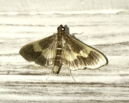
(c) Alexis Felipe, some rights reserved (CC BY-NC)
Overview
mountain in Cuba
Sierra del Mica is a mountain in Santiago de Cuba, Cuba. It is located at approximately 20.3342°, -75.515°.
In a straight line it lies 47.0 km from its provincial capital, 772.1 km from Havana and 52.1 km from the nearest airport with scheduled flights.
The nearest recorded places in the atlas are Alto Buenaventura (5.1 km to the east), Loma Piedra Labrada (8.0 km to the north-west), Loma Azul (8.3 km to the south-west), Loma Saba Grande (8.4 km to the north-west), Alto del Dajao (9.4 km to the east) and Segundo Frente (8.8 km to the north).
Highlights
Verified highlights
Source-backed classifications from the CubaAtlas record — each opens the places that share it. No star ratings.
Your companion for Sierra del Mica
honest data · every value datedConditions
No dataLive weather conditions aren't connected here yet. When they are, this strip will summarize what's realistic to do today — and flag anything to check first — each value stamped with how fresh it is and where it came from.
Get there
20.33420, -75.51500Opens your maps app for turn-by-turn directions. CubaAtlas doesn't track your location.
Tropical outlook
LiveChecking the National Hurricane Center…
Weather
No dataAir temperature, wind, rain chance and UV for planning your day.
Weather adapters (NOAA + Cuba's INSMET) are the next feed to wire — each value will be stamped with its observation time and source.
Wildlife
LiveLoading recent wildlife records…
Daylight & season
Local time CDT (UTC−4). Computed from the date and coordinates — accurate to about a minute. Recent
Within the Atlantic hurricane season (Jun 1 – Nov 30). Check active advisories before coastal or boating plans.
Water & safety
No dataWhether the water and conditions look manageable today for swimming or wading.
Once sea state and any advisories are connected, this frames conditions as favorable, use-caution, or not-recommended — always with the reason. It will never certify safety; final judgment is yours and the local lifeguard's.
Seismic activity
LiveChecking USGS for recent seismic activity…
Emergency
- 106Police (PNR)Recent
- 104Ambulance / medicalRecent
- 105FireRecent
- +53 7 866 4499Asistur (traveler assistance)Recent
State travel-assistance service for visitors (medical, legal, financial help).
These are Cuba's publicly published national numbers. Coverage, language support, and response times vary by area and are not verified in real time — confirm the correct local number with your accommodation on arrival.
CubaAtlas states how much it knows and how fresh it is. Values marked “No data” aren't connected yet — we show you the official source instead of guessing. Not for navigation, rescue, or legal decisions.
What's near Sierra del Mica
Nearby places
Distances are straight-line, measured between recorded coordinates — not driving distance.
Mapped features nearby
Named places recorded in OpenStreetMap around this one, nearest first — distance shown for each.
Named places mapped nearby include Mango de Polilla, Mangos de Polilla, El Toro, Yamagua de Puyáns, Los Moragas, El Puerto, Seboruco, Arroyo Macío, CEDCOM, El Valle, La Lombriz, La Felita de Trujillo, Carmen Rosa Trescientos Cuatro, Arroyo Purial, Los Reynaldo and Cine Alto Songo.
- Mango de Polilla · hamlet
- 1.6 km
- Mangos de Polilla · hamlet
- 1.8 km
- El Toro · hamlet
- 5.5 km
- Yamagua de Puyáns · estate
- 5.5 km
- Los Moragas · hamlet
- 5.8 km
- El Puerto · hamlet
- 6.2 km
- Seboruco · hamlet
- 6.7 km
- Arroyo Macío · river
- 7.4 km
- CEDCOM · works
- 7.8 km
- El Valle · neighbourhood
- 8.3 km
- La Lombriz · hamlet
- 10.0 km
- La Felita de Trujillo · hamlet
- 10.9 km
- Carmen Rosa Trescientos Cuatro · hamlet
- 12.5 km
- Arroyo Purial · river
- 14.7 km
- Los Reynaldo · hamlet
- 16.7 km
- Cine Alto Songo · theatre
- 26.8 km
Around Sierra del Mica
63 named civic, cultural, natural and service places are mapped within about 15 km of Sierra del Mica, across 23 categories. Open any category to see it on the map, centred on Sierra del Mica.
Notable near Sierra del Mica

Frank Pais García
Attractions
Frank País is a municipality in the Holguín Province of Cuba. The municipal seat is located in the town of Cayo Mambí. The municipality was named for the revolutionary Frank País.
🏛️ Culture & heritage 8
⛰️ Nature & terrain 2
🏭 Industry & resources 6
🏥 Health & care 6
🎓 Education 11
🏦 Civic & services 11
🚉 Transport 1
🏟️ Sport & leisure 7
🛒 Shops & markets 8
🛏️ Stay 3
What Sierra del Mica makes
6 working sites mapped — energy, industry, mining, farming, fishing and ports.The whole economy →
⚡ Energy 1
Parque Solar Fotovoltaico Mayarí Arriba
🏭 Industry 5
CEDCOM · Centro de Eelaboración · Fábrica de Conservas · Fábrica de Helados · …
Official information and sources
generated from facts
- Wikidatageographic
- Wikimedia Commonsmedia