Cays & islands · Guantánamo
Cayo Saetía
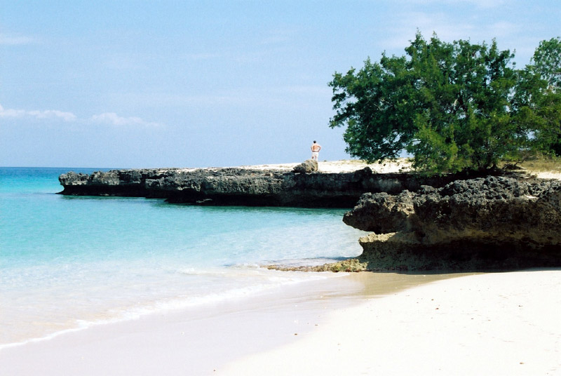
Cayo Saetía is a cay at 20°45′30″N 75°31′34″W in Guantánamo province. Cayo Saetía is a 42 km2 (16 sq mi) cay (island) in Holguín Province, Cuba. It belongs to the municipality of Mayarí.
Cayo Saetía: coast and water
2660 m at 291°: Ensenada Cristo (bay); 2870 m at 195°: Punta Limón (point); 3700 m at 4°: Punta Mayarí (point); 3720 m at 222°: Punta Angostura (point); 4320 m at 258°: Ensenada Hoya (cove); 4820 m at 101°: Punta Luberal (point); 5720 m at 290°: Punta Carenero (point); 5970 m at 123°: Punta Los Cocos (point).
Cayo Saetía: islands
3010 m at 203°: Cayo Limón (island); 3050 m at 155°: Cayo Pájaros (island); 4680 m at 189°: Cayo Ratón (island); 5360 m at 150°: Cayo Grande (island); 6260 m at 222°: Cayo Yarey Grande (island); 6370 m at 224°: Cayo Madama (islet); 6580 m at 190°: Cayos las Pedronas (island group); 6950 m at 244°: Cayo Corúa (island); 7020 m at 157°: Cayo Lechuza (island); 7440 m at 159°: Cayo Santillana (island); 8760 m at 162°: Cayo Tortuga (island); 14460 m at 312°: Cayo Iguana (island).
Cayo Saetía: inland
6970 m at 119°: Carenerito (settlement); 7440 m at 323°: La Calera (locality); 7550 m at 308°: Melilla (settlement); 7760 m at 174°: Río Levisa (stream); 7820 m at 249°: Felton (settlement); 7850 m at 194°: Nícaro-Levisa (settlement).
Cayo Saetía: distances
7770 m at 249°: Felton; 8700 m at 101°: Corinthia Beach; 8950 m at 190°: Nicaro-Levisa; 82130 m at 272°: Frank Pais International Airport ; 24020 m at 292°: Port of Antilla (port); 94190 m at 203°: Marina Marlin Santiago de Cuba (marina).
Protected: 25680 m at 155°: Parque Nacional Pico Cristal; 30150 m at 317°: Comité Militar Banes.
Cayo Saetía: close by
3010 m at 203°: Cayo Limón (cay); 3050 m at 155°: Cayo Pájaros (cay); 4680 m at 189°: Cayo Ratón (cay); 4830 m at 221°: Isla Makey (cay); 5360 m at 150°: Cayo Grande (cay); 6260 m at 222°: Cayo Yarey Chico (cay); 6260 m at 222°: Cayo Yarey Grande (cay); 6370 m at 224°: Cayo Madama (cay); 6580 m at 190°: Cayos las Pedronas (island group); 6960 m at 244°: Cayo Corúa (cay); 7020 m at 157°: Cayo Lechuza (cay); 7440 m at 159°: Cayo Santillana (cay).
Cayo Saetía: on and around
Within 15 km: 10 guest houses & hostels, 9 coral reefs, 8 schools, 6 police & fire, 5 mines & quarries, 5 stations & terminals, 5 places of worship, 4 factories & works, 4 clinics & polyclinics, 3 theatres & arts.
1180 m at 298°: Cantera (mines & quarries); 2670 m at 348°: Playa Cayo Saetía (stations & terminals); 3670 m at 297°: Casa de los Pilotos (guest houses & hostels); 5430 m at 291°: Anfiteatro (theatres & arts); 5520 m at 291°: Campamento de Pioneros Cayo Seitía (camp sites); 5820 m at 209°: Puerto de Nicaro (mines & quarries); 5840 m at 207°: Establecimientos de bebidas y alojamiento (attractions); 5890 m at 205°: Casa Videojuegos EHR (guest houses & hostels); 6190 m at 205°: Casa de alquiler (guest houses & hostels); 6260 m at 225°: Cayo Madama isla (attractions); 6710 m at 199°: Cine (theatres & arts); 6950 m at 108°: Campismo Popular Carenerito (camp sites); 7420 m at 260°: La Guayaba (urban parks & plazas).
Cayo Saetía: notes
Some cays belong to resorts and are closed to day visitors.
Getting to Cayo Saetía
- By boat: the route Antilla - Cayo Saetía is mapped. Schedules and operators change, so confirm locally before travelling.
- Boat terminal: Playa Cayo Saetía is mapped as a ferry terminal for Cayo Saetía.
- Navigation: the lighthouse Faro de Punta Mayarí stands about 3.8 km away.
Sources and data
Name and position: OpenStreetMap (ODbL) (record). Distances are straight-line measurements from these coordinates. Satellite imagery: Esri, Maxar. Named places: GeoNames (CC BY 4.0). Positions from public gazetteers can be approximate, so confirm a location with a local operator before you travel.